Gray catbirds live up to their name.
When one is caught — even safely by a trained professional — it will squirm, trilling and chirping in a way that’s only a stone’s throw from a “meow.” Upon release, the catbird is quick to remind you of your original transgression. Instead of majestically taking flight, it will do something like this:

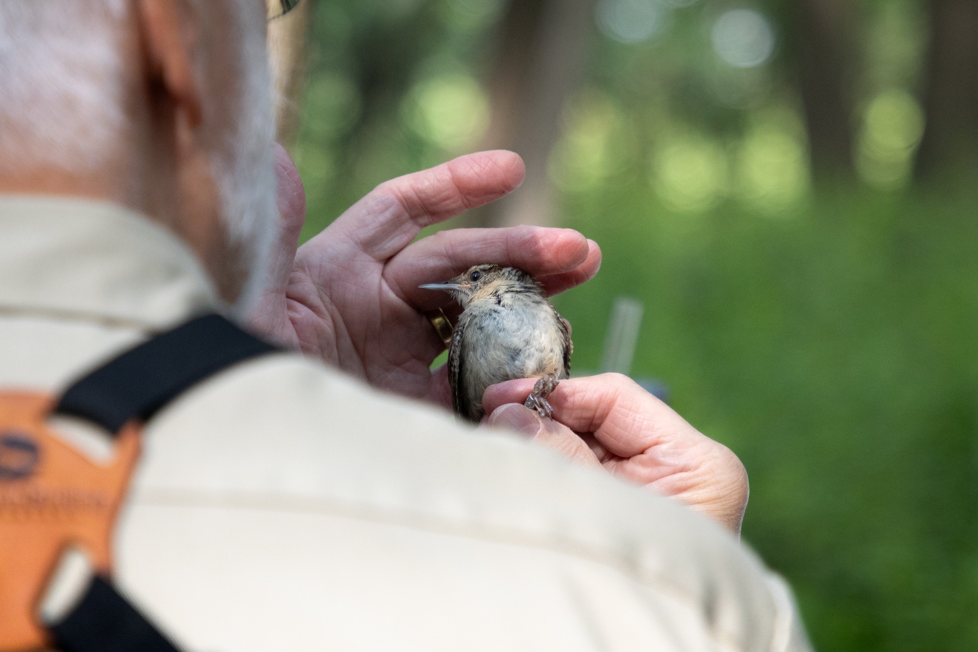
It’s impossible to see, but that gray catbird had a small aluminum band on one of its legs. It was affixed there by trained District staff who, ten times between May and August, catch, assess, catalogue, and release whatever bird flies into their nets, all under a special permit issued by the U.S. Geological Survey.
The aluminum band is the key to a plethora of information: The bird’s age, sex, last recorded weight, last recorded location, and relative health. For that catbird: over two years, probably four, male, 33.9 grams, DuPage County, and healthy.
“Those aluminum bands act as a kind of record of distance and time,” District ecologist Brian Kraskiewicz said. “That particular bird was found and banded at this specific place. If it’s found three years later, whoever finds it will know where this bird was originally banded and how old it was at that time. This will give researchers the ability to track where birds go and how long they live.”
“How is it so possible something so small can give us such valuable information?” applies not just to the aluminum tag but also the reason it’s applied at all. The Monitoring Avian Productivity and Survivorship program, as the name would imply, tracks bird population health and longevity across North America. Every summer, data are collected at 1,200 MAPS stations across the United States and Canada, including the one in DuPage County. Many of these stations have been operational for decades, and every one of them is standardized.
At the end of the season in August, MAPS data are reported to the Institute for Bird Populations, who first started the program and publishes the season’s findings online, available to any birder or scientist for free. MAPS has aided and inspired research papers and, bird by bird, provides a yearly checkup on the health of North America’s ecosystems. The diagnosis is detailed: Since its inception in 1989, the program has captured and catalogued over 2.5 million birds.
That day, we caught six.
District staff handle birds with care during banding.
“The whole purpose of the program is to capture breeding birds and then hopefully recapture them in subsequent years,” Kraskiewicz said. “That’s how we keep track of the population. If you’re capturing birds in the future, you know they’re surviving. If you capture young birds, you know they’re reproducing.”
Kraskiewicz, equipped with a special binocular harness and a dry smile, has headed the MAPS program for the District since 2010. He can instantly identify any bird species on sight or by sound. Out in the field, Kraskiewicz’s attention was often diverted by whatever bird happened to be darting through the understory. Some of them, inevitably, will fly into a mist net.
Strung at ground level before every MAPS session, the District’s 10 mist nets — each a little over eight feet tall and nearly 40 long, checked on the hour, and placed in the same locations year after year — are nearly invisible up close and completely disappear from afar. They’re basically basketball hoops. Unaware birds will fly into the upper flat part of the net, flail, and then fall into the lower basket, unable to escape. Less than an hour later, District staff make their rounds and gently place any bird they find into a canvas bag the size of a pencil pouch.
The result is an efficient capture-and-release system that entangles a bird quickly and harmlessly, analyzes it with expediency, and lets it go after it’s been logged. For the bird, the experience is an irksome hour of bagging, nagging, and tagging. For scientists, it begets indispensable data.
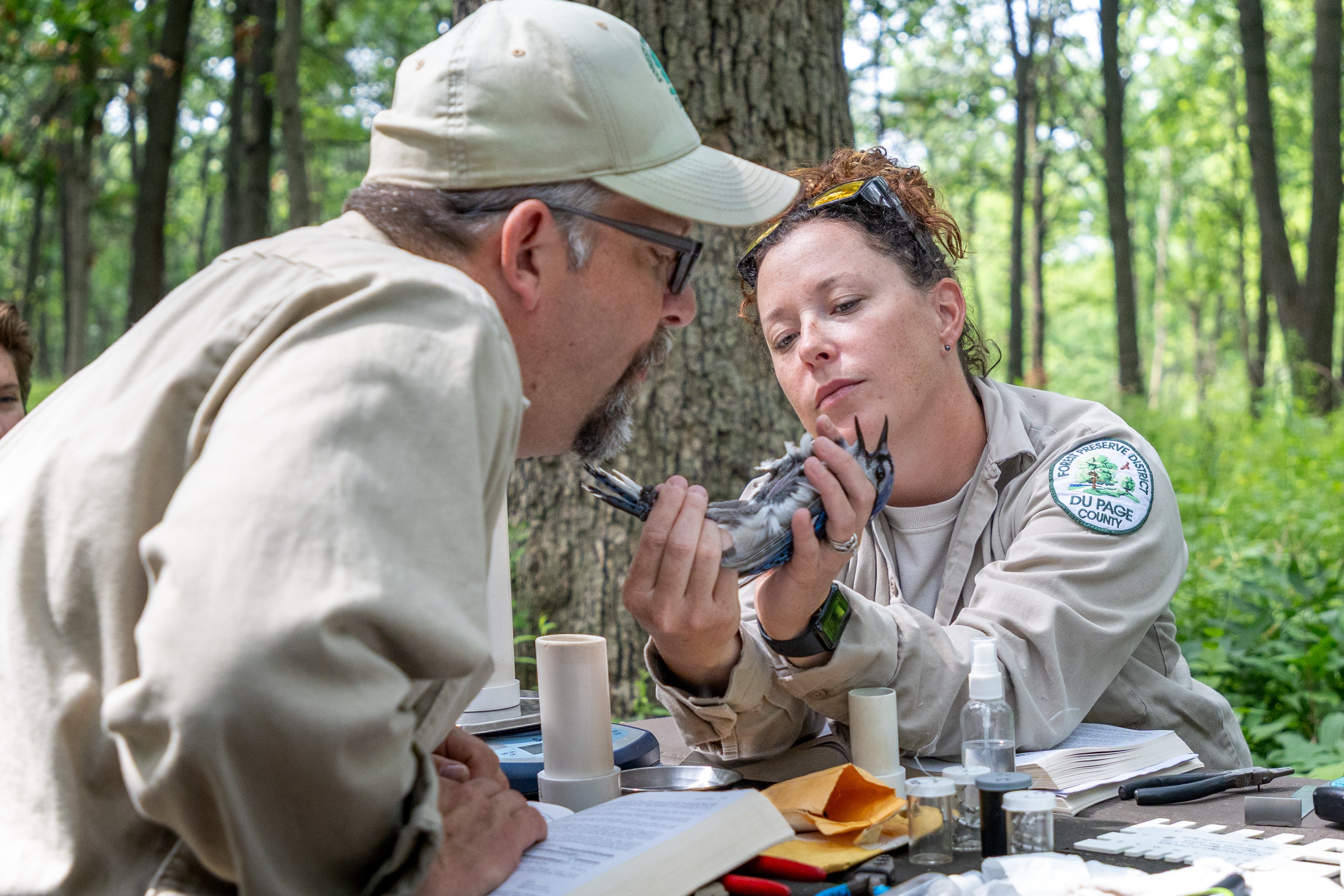
Determining if a bird is breeding is only possible by blowing on its belly.
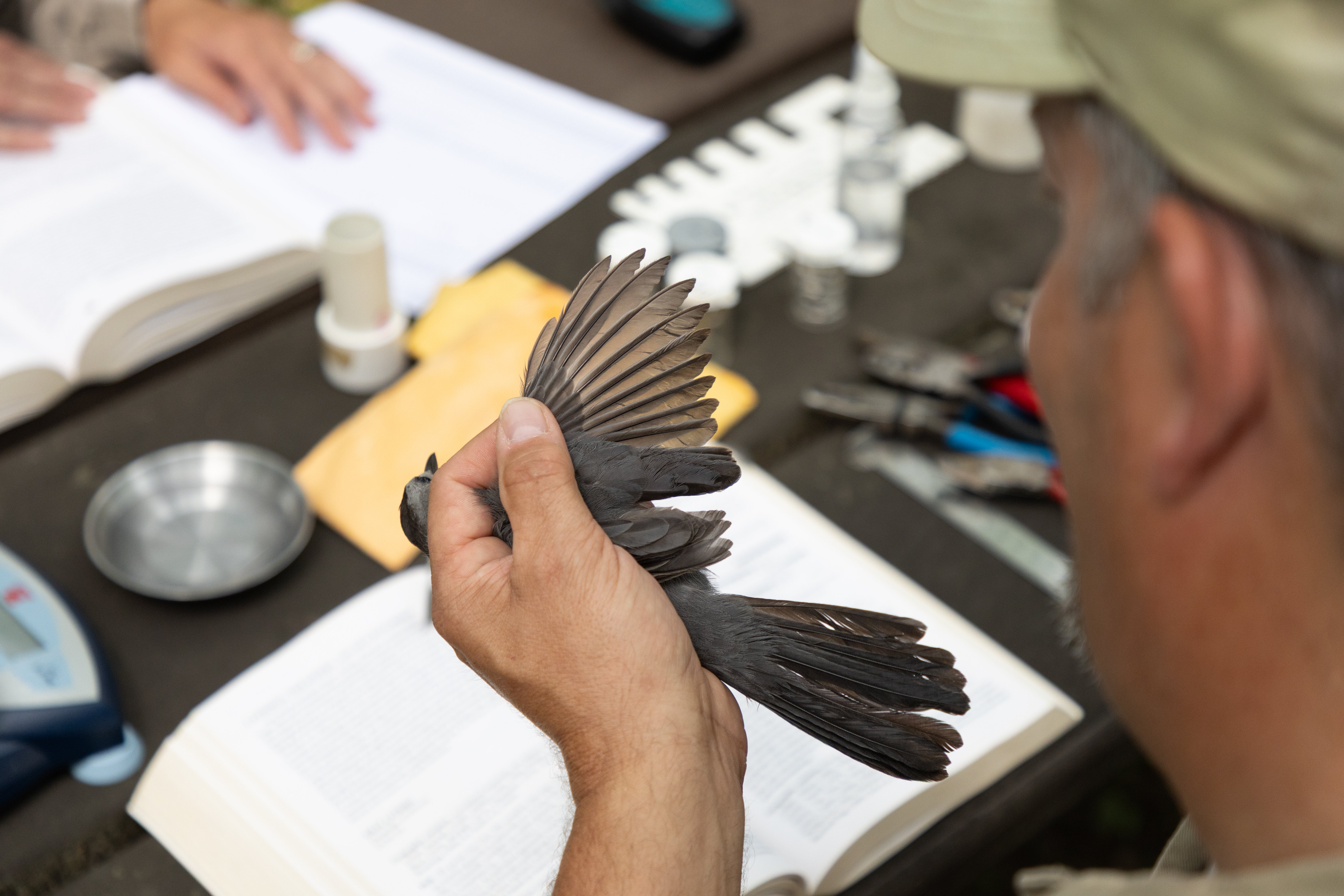
“When we capture a bird, we’re looking for a few things,” Kraskiewicz said. “For age, we look at the feathers. Juvenile feathers have a different structure. They grow really fast so the bird can get out of the nest, but they’re not the strongest. Those are called ‘hatching-year birds.’”
As birds age, their softer, juvenile feathers molt into hardy, UV-reflecting, waterproof plumage. A bird that hasn’t fully matured and still has patches of young feathers is classified as a “second year.” Then on, it’s anyone’s guess.
“Most of what we catch will be ‘after second year’ birds,” Kraskiewicz said. “We know by the feather wear and molt pattern that some were born at least two years ago. After that, I don’t know. It could be three years old, five years old — it’s hard to tell. They all grow the same feathers at the same rate.”
Then, without a hint of shame, the District’s MAPS team asks if the bird is breeding. There are two giveaways, accessible only by blowing on a bird’s belly. Females will develop what’s called a “brood patch” after they’ve hatched eggs — their breast feathers will thin out, their skin will wrinkle, and their blood vessels will swell, allowing their body heat to directly incubate their eggs.
As for males, its “cloaca,” a small orifice near the bottom of its torso, will bulge.
“All these reproductive data will help how the bird banding program reflects the larger ecosystem,” Kraskiewicz said. “If you’re finding a lot of birds that aren’t in reproductive condition, something is wrong.”
What happens when something does go wrong?
Stay tuned for Part 2.
Gabe Lareau