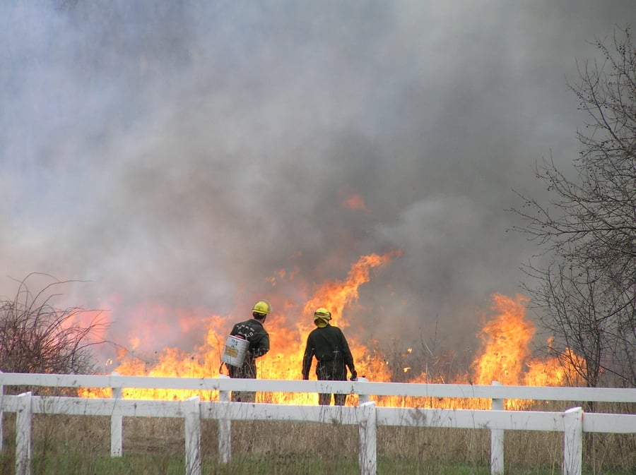
As flames bound across a field in a DuPage County forest preserve, District staff standby with calm confidence. This is fire with intent. And it’s been planned for months, if not years.
Forest Preserve District staff use a slew of technology to map, plan, and determine what part of the landscape to burn on any given day. The burns are a method of conservation. They’re used to control the spread of invasive species, and at a significant value, according to Brian Lawrence, natural resources restoration supervisor, who has been a part of more than 400 prescribed burns.
“Prescribed fire is our most cost-effective resource management tool,” Lawrence said. “We’re using fire to stimulate native plant growth and to control invasive species, especially woody invasive species.”
But these fires are not just a rash decision made after someone sees buckthorn while hiking in a forest. District staff use multiple databases to map the area, prepare burn units in advance, and use weather forecasting as well as on-sight readings to determine what areas to burn and when.
Prescribed burns clear the forest floor of leaf litter and invasive species, allowing native plants to sprout.
The region’s burn season runs from fall through spring and is heavily dependent on the weather. However, District staff start preparing for the upcoming season in late summer with the creation of a burn list, which is reworked each year.
They use their Burn Day Decisions App to map the District’s 487 burn units. In the software program, clicking on a unit will show details like acreage, when it was last burned, and which wind direction is best for that particular unit. These maps and details can be shared with contractors to help them create burn plans.
Units range in size from an acre or two to about 240 acres, with the average size being 28 acres, according to Lawrence. The unit’s boundary lines are color-coded in the app to indicate whether fire break lines have been cut.
In October, crews start mowing fire break lines. They must wait until the grass dries out so it doesn’t start growing again and nullify their work. The rule of thumb for break lines is two- to three-times the width of the height of the fuel. For example, if grasses are 5 feet tall then the mow lines should be at least 10 to 15 feet wide, though the District errs on the side of caution, creating extra wide breaks. At woodland sites, workers generally use leaf blowers to clear fire lines of debris and expose dirt to form break lines the morning of a burn.
When environmental factors are prime for burning, Lawrence, burn bosses, and other staff will consult their Burn Day Decisions App, weather forecasts, and their “Prescribed Burn Report Database,” which the District has been updating since about the turn of the millennium. The database allows the officials to sort burn units by preserve as well as best wind direction.
The wind is one of the most important factors when deciding what to burn. State law requires at least 5 mph of wind to help disperse smoke. The District’s burn prescriptions typically call for winds speeds of 5 to 15 mph for open sites and 5 to 20 mph for woodlands. Having a bit of wind allows burn crews to control the direction of the fire and to keep smoke away from homes and businesses.
“In all of our prescriptions we have attempted to mitigate for smoke effects,” Lawrence said.
District staff use the wind to disperse smoke and keep it away from homes and businesses.
The District’s database also includes a list of people who need to be notified for each burn unit. After deciding where to burn on the day of a fire, each burn boss will call or email interested parties, which include local emergency services, county dispatch, and others who sign up for notifications, including local residents.
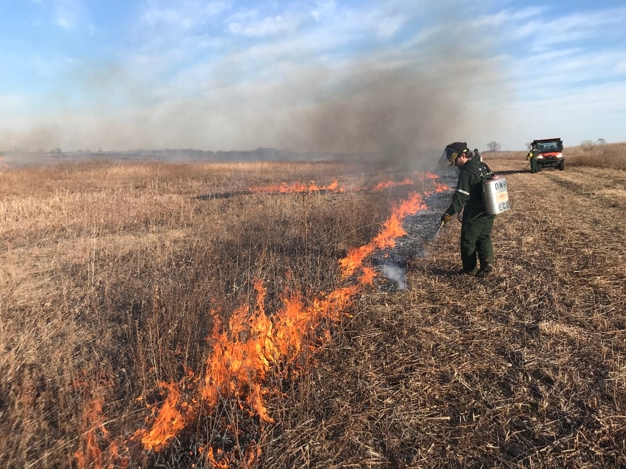
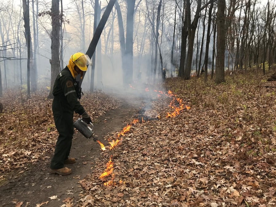
Crews of District employees and contractors will then disperse to their assigned unit. If applicable, they’ll erect signs while taking measurements to ensure the weather matches the forecast. Crew members also inspect the burn unit to make sure there are no hazards, like wood piles near large trees or utility poles. Then they’ll use a 3-1 mixture of diesel and gasoline in a drip torch to ignite the unit.
Crew members oversee the fire in flame-resistant coveralls, hardhats, gloves, and leather boots. They communicate via two-way radios and use ATVs and trucks equipped with water tanks to travel along the fire breaks. If a hotspot needs attention, a crew member can use the water on their vehicle or hike in with a five-gallon tank on their back.
In a matter of hours, fire can clear dozens of acres of invasive species, or at least a high percentage of them. Native plants are adapted to survive and thrive after fire. For example, the thick bark of oak trees protects their trunks, and native prairie grasses have underground root networks that are protected from flames by the soil. Without invasives hoarding nearby open space, the native species proliferate.
Once the fire burns out, crews will inspect the site and extinguish any smoldering hotspots before opening the land back up to the public. Then supervisors will update the District’s database and decision app, which they can access from just about anywhere — a stark contrast from decades past when supervisors spread maps across a conference table and listened to a weather radio for updates to help them plan a prescribed burn, an effort to improve the county’s natural landscape.